Concept Simulators / Storing and finding data
Nearby search
Grids, geohash cells and quadtrees, and the edge problem that loses results.
On the roadmap:Staff Engineer · step 3: Maps and location
Settings
Measure the distance to every place. Always right, and slower as the list grows.
Places checked per search
50,000
Results found
278
Results missed
0%
Cells or areas opened
none
Every search measures 50,000 distances to find about 278 places. It is exact, and it does not scale.
One search, close to a cell edge
- Found: inside the circle and looked at
- Missed: inside the circle, never looked at
- Checked, but outside the circle (wasted work)
- Never touched
- Shaded squares are the cells or areas that were opened. The dashed circle is the search.
In plain words
Finding the places within a distance of a point is a search problem on a map. Checking every place works for a few thousand. For millions you cut the map into cells, or into areas that adapt to how crowded they are, and only look nearby. The trap is the edge of a cell, where a place just across the line is easy to miss.
Why it matters
Every ride-hailing, delivery and dating app asks this question all the time. The answer has to be fast, and it has to be right near the edges, which is where a naive grid fails. Here you can see how much work each method does, and watch the places it misses.
How real systems do it
The simulation is a simplified model. Here is what production systems add or do.
- A geohash turns a location into a short string where places that are close share a long prefix. Searching a geohash cell and its eight neighbours is the standard way to avoid the edge problem. Redis GEO commands use a geohash internally.
- Uber's H3 divides the world into hexagons, which have the useful property that all six neighbours are the same distance away. Google's S2 library covers the sphere in cells along a space-filling curve and is used by many mapping systems.
- PostGIS and other spatial databases index points with R-trees, which group nearby shapes into rectangles, and quadtrees and k-d trees are used in memory.
- Real systems add a final step: the cells give a short list of candidates, and then the exact distance is computed for each. The cells only have to be good enough to make the list short.
Study: Nearby search
Once you have played with it, learn the same idea from people who build these systems. Watch first for the picture, then read for the detail.
 16 min
Basic System Design for Uber or Lyft | System Design Interview Prep
Interview Pen · 899K views
Then
 37 minUBER System design | OLA system design | uber architecture | amazon interview questionTech Dummies - Narendra Lakshmana Gowda · 851K views
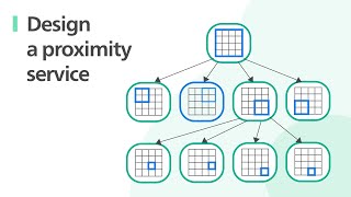 25 minFAANG System Design Interview: Design A Location Based Service (Yelp, Google Places)ByteByteGo · 602K views
 1 h 3 minDesign Uber w/ a Ex-Meta Staff Engineer: System Design Interview breakdownHello Interview · 589K views
 9 minUnlock the Power of Event-Driven Architecture: How Netflix & Uber Handle Billions of EventsByteMonk · 542K views